Viewing: April, 2019
April 23, 2019
Blending Geography with Literacy and Technology

We first made this MyMap, in which students brainstormed different landmarks and classified them as local, regional, national, or international landmarks.
In our class, we’ve been blending one of our social studies focus areas (map skills) with our various reading units. Many of you are familiar with Google Maps, which many of us use for GPS navigation or to plan routes. But you may not be familiar with Google MyMaps. MyMaps is a tool available to educators that lets students and teachers build their own custom maps. In these custom maps, users can pin locations, link to photos and information available online, write their own custom content, measure distances, show routes, and much more. In the fall, we first used MyMaps to learn about the difference between local, regional, national, and international landmarks. Students brainstormed different landmarks and classified them based on how well-known they were. This also helped students to become familiar with the idea of MyMaps.
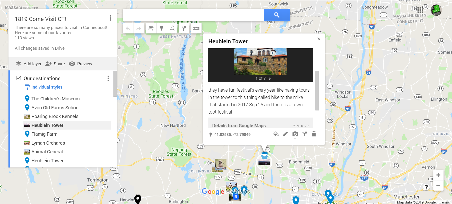
Students shared information about their Connecticut landmarks, including both photos and text, in order to create a virtual tour of the state.
Shortly after, we used MyMaps to create a virtual showcase for the students’ Connecticut Landmark Advertisement Projects. We scanned in the students’ advertisements, and they found the locations on the map, wrote a few sentences to introduce us to their landmark, and embedded photos of their advertisement as well as other found photographs of that landmark. For privacy reasons, an interactive version of this map is not available here. (It has student names included.) But students can always share this with their families from their Google Classroom page.
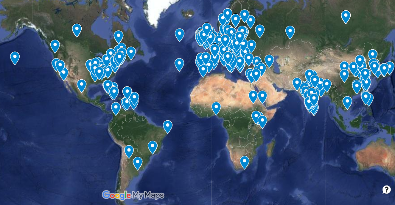
This image shows the heritage of members of the PGS community.
In January, in preparation for our annual multicultural fair, students in our class mapped out communities from which members of our PGS community originally came. Sometimes we knew specific cities, and in other situations, we knew only the country. While this may sound like a massive undertaking, we quickly built this map, thanks to the students’ proficiency with MyMaps. At the multicultural fair itself, students and families got to enjoy an animated tour of each of the 604 locations as we used Google Earth to zoom in and out of each community.

Also in January, our class started a study of the outstanding novel Number the Stars. As we read the book, which teaches students about life in Denmark during the German occupation in 1936, we found that many real-world landmarks were included in the book (which is considered to be realistic, historical fiction). As we read, we plotted the locations on a MyMap and have been able to better understand the text by learning about many of the places. For example, in the book, the narrator and character Annemarie tells the reader that they can see across the water to Sweden. By measuring, we discovered that it is about 10 miles from the shoreline town of Gilleleje to the closest part of Sweden. Students found their own homes and measured to locations that were a comparable distance away. (They discovered, for example, that seeing the Hartford skyline while driving over Avon Mountain is probably similar to the sight of Sweden from the harbor town of Gilleleje.) Other students learned about Amalienborg, the beautiful palace home to the former King Christian X of Denmark, who is included in the novel. A 360-degree tour of the palace courtyard gave students a glimpse into this far away land. Students are now pulling together the information they’ve learned and are going to embed these facts into our MyMap, which will create a virtual tour of the country of Denmark, as it relates to Number the Stars.
I’m excited to share that we’ve been accepted to share our work with MyMaps at the State Capitol next week! Four students will have the opportunity to join me to showcase our work with this creative resource! If you have any questions about this event, or about our use of MyMaps in general, please feel free to contact me.
Posted in Class Updates|By Jon Moss